






Scegliere tra le migliori escursioni in giornata in Ecuador non significa solo confrontare i paesaggi. L’accessibilità, l’altitudine, le condizioni dei sentieri, la durata del percorso e i servizi disponibili sono tutti fattori che possono influenzare la scelta dell’itinerario più adatto a te.
Questa guida spiega come raggiungere ciascun sentiero e cosa ci si può aspettare di trovare al punto di partenza. Aiuta inoltre a confrontare la durata del percorso, il livello di difficoltà e il tipo di escursionista a cui ciascun itinerario è più adatto, spiegando al contempo in quali casi l’assistenza di una guida locale può facilitare gli spostamenti, la pianificazione e l’accesso.
ESCURSIONI GIORNALIERE VS. TREKKING IN ECUADOR
In questa guida, per “escursione giornaliera” si intendono i percorsi che possono essere completati senza campeggiare né portare con sé l’attrezzatura necessaria per il pernottamento. Il trekking prevede solitamente diversi giorni di percorrenza, con pernottamento in campeggi, rifugi o presso le comunità locali.
I percorsi riportati di seguito sono pensati per escursioni in giornata. Il loro grado di difficoltà varia comunque a seconda dell'altitudine, del dislivello, del terreno e delle condizioni meteorologiche.

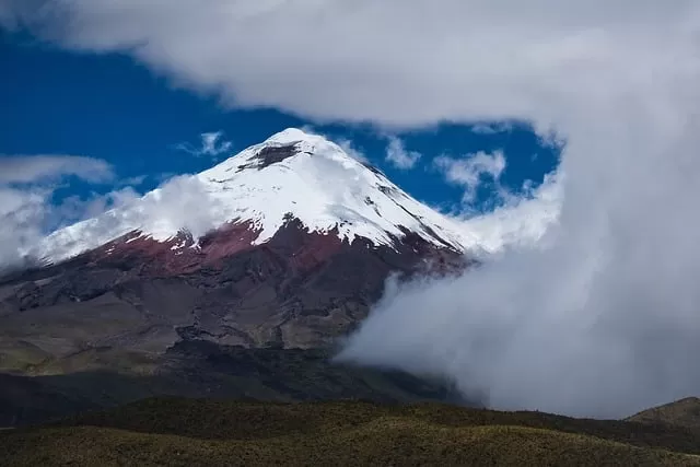
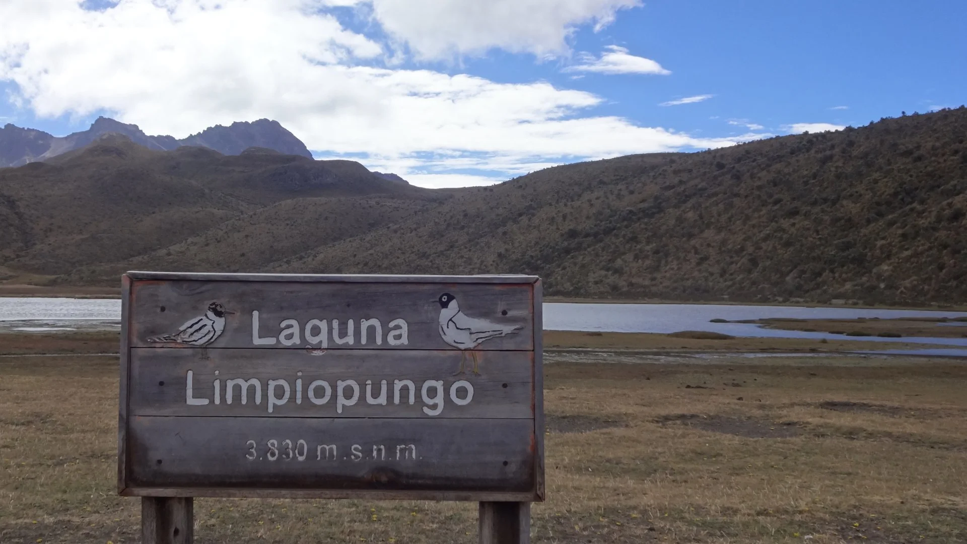
LAGUNA DI LIMPIOPUNGO NEL PARCO NAZIONALE DEL COTOPAXI
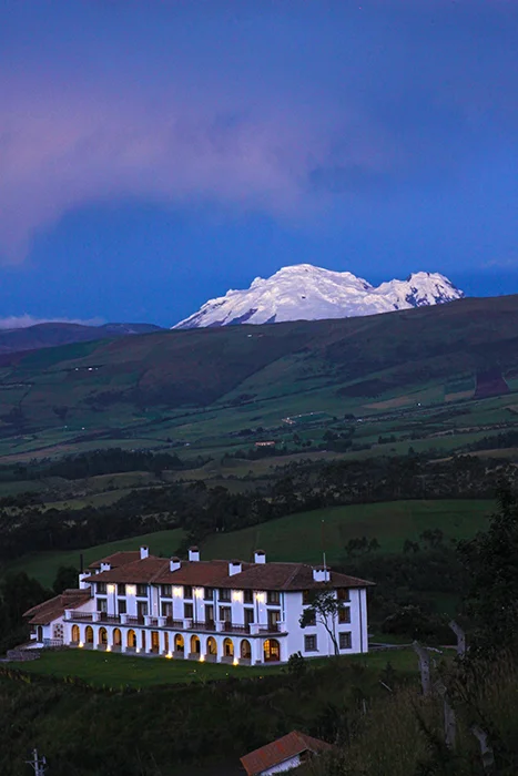
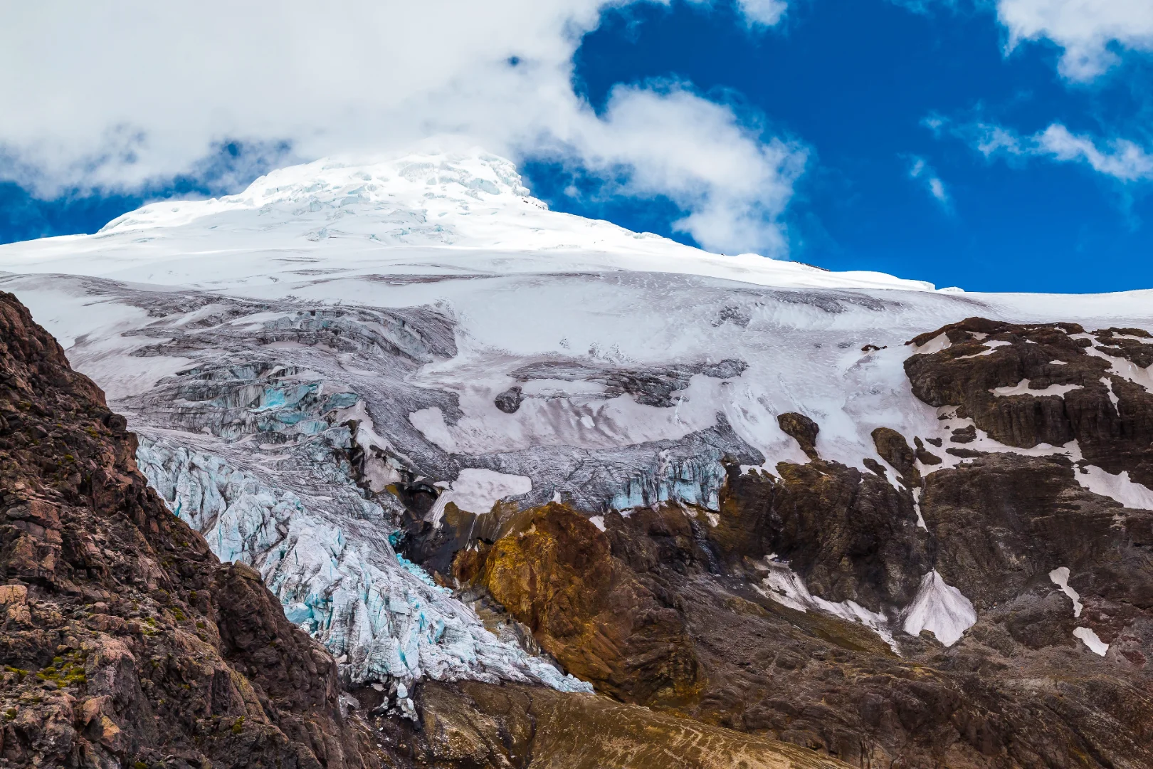
Ideale per:Una piacevole passeggiata in alta quota, paesaggi di páramo e vista sul Cotopaxi quando il tempo è sereno.
DOVE SI TROVA E COME ARRIVARCI
La laguna di Limpiopungo si trova all’interno del Parco Nazionale del Cotopaxi, a sud di Quito. È possibile visitarla nell’ambito di una gita di un giorno dalla capitale oppure inserirla in un itinerario più lungo attraverso le Ande ecuadoriane.
Responsible Travel include Limpiopungo nella suaEscursione di un giorno al Parco Nazionale del Cotopaxi, con trasporto privato, una guida che parla inglese e i biglietti d’ingresso indicati nell’itinerario.
CONDIZIONI DEL PERCORSO E LIVELLO DI DIFFICOLTÀ
Ilfare un giro intorno alla lagunasi snoda su un terreno relativamente pianeggiante. È meno impegnativo dal punto di vista fisico rispetto ai percorsi che salgono verso le pendici più alte del Cotopaxi, anche se l’altitudine può rendere la camminata più faticosa del previsto.
Nel páramo le condizioni meteorologiche possono cambiare rapidamente. Il vento, le nuvole basse o la pioggia possono compromettere la visibilità e le condizioni del sentiero; si consiglia quindi di indossare indumenti pesanti e una giacca impermeabile.
COSA ASPETTARSI
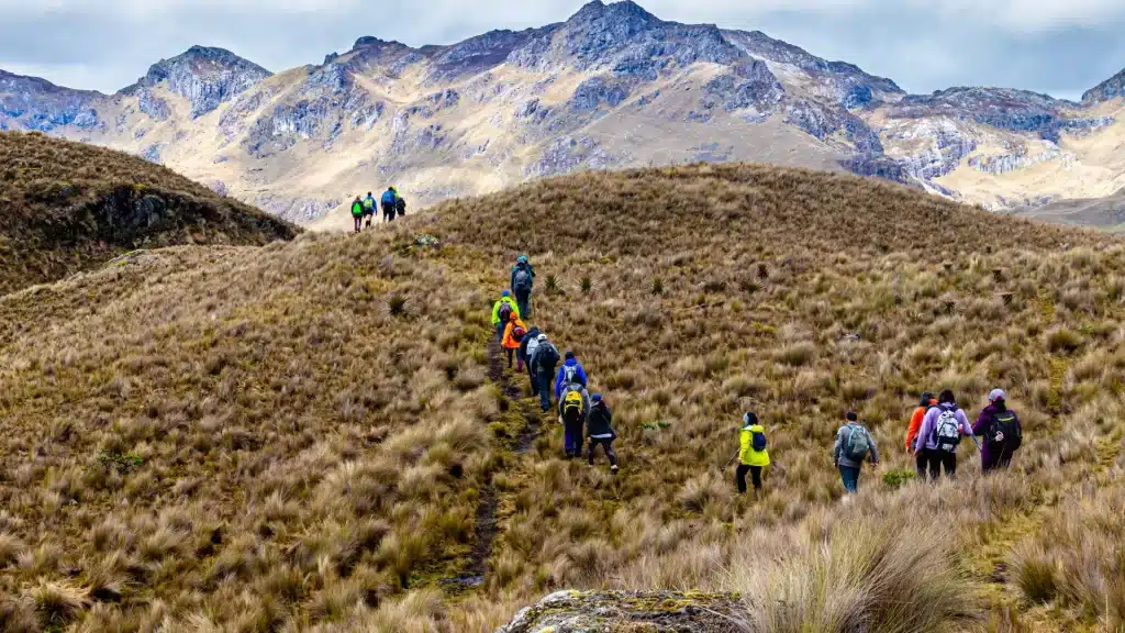
La laguna è circondata da un páramo aperto, da cui nelle giornate limpide si gode di una vista sul Cotopaxi e sulle montagne circostanti. Le zone umide costituiscono inoltre un habitat per l'avifauna andina, rendendo questa località una tappa imperdibile per i viaggiatori appassionati di natura e fotografia.
QUANDO UNA GUIDA È UTILE
Una guida locale può illustrare l'ecosistema del páramo, aiutare a riconoscere la fauna selvatica e adattare la visita alle condizioni meteorologiche e di accesso del momento. Per i viaggiatori provenienti da Quito, un tour organizzato semplifica inoltre il trasporto e le procedure di registrazione presso l'area protetta.
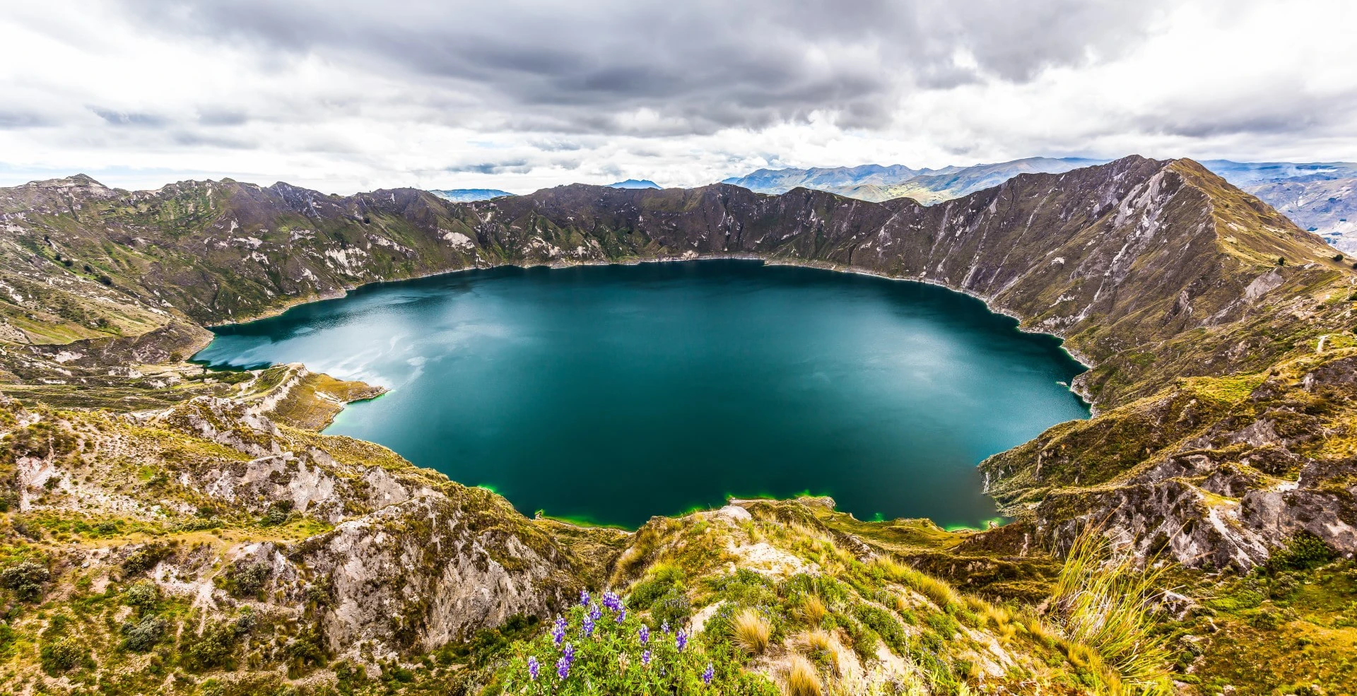
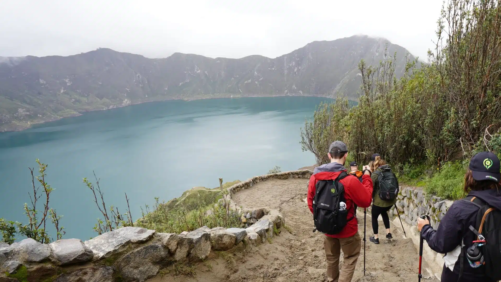
LAGO DEL CRATERE DI QUILOTOA
Ideale per:Panorami d'alta quota, percorsi escursionistici flessibili e viaggiatori che desiderano adattare l'esperienza al tempo a loro disposizione e al proprio livello di forma fisica.
DOVE SI TROVA E COME ARRIVARCI
Quilotoa si trova nella provincia di Cotopaxi, a circa tre o quattro ore di strada da Quito. Chi viaggia con i mezzi pubblici di solito fa scalo a Latacunga o Zumbahua, mentre i tour privati possono raggiungere direttamente il villaggio situato sul bordo del cratere.
L'area principale dedicata ai visitatori si trova nei pressi dei punti panoramici e comprende ristoranti, bancarelle di artigianato, alloggi e servizi di base. Si consiglia di verificare in loco la disponibilità dei servizi e le modalità di pagamento, nonché di portare con sé contanti.
PERCORSI A PIEDI E LIVELLO DI DIFFICOLTÀ
Una visita a Quilotoa può variare da una breve sosta ai punti panoramici a una passeggiata lungo una parte del bordo del cratere. I viaggiatori che dispongono di tempo a sufficienza e di una forma fisica adeguata possono anche scendere verso la laguna e tornare indietro lungo lo stesso sentiero ripido.
La discesa e la salita richiedono solitamente da circa 1,5 a 3 ore, a seconda dell'andatura, delle soste e delle condizioni del sentiero. Il percorso può risultare impegnativo a causa del terreno ripido e dell'altitudine di circa 3.900 metri sul livello del mare.
La pioggia può rendere alcuni tratti fangosi o erosi, mentre la nebbia può ridurre la visibilità nei pressi del cratere. Il percorso definitivo va quindi scelto in base alle condizioni meteorologiche del momento, allo stato dei sentieri e alla forma fisica del viaggiatore.
ESCURSIONE DI UN GIORNO O TREKKING DI PIÙ GIORNI
Questa guida si concentra su Quilotoa come meta per una gita di un giorno. Il percorso più lungoAnello del Quilotoacollega località come Sigchos, Isinliví e Chugchilán nell’arco di diversi giorni e richiede una pianificazione, un alloggio e un trasporto specifici.
UNA TAPPA FLESSIBILE IN UN ITINERARIO PERSONALIZZATO
Responsible Travel include Quilotoa nei viaggi più lunghi attraverso le Ande ecuadoriane, comprese le passeggiate lungo il bordo del cratere. La visita può essere adattata, da una semplice sosta presso un belvedere a un’escursione più lunga, a seconda delle condizioni meteorologiche, delle normative locali e del ritmo del viaggiatore.
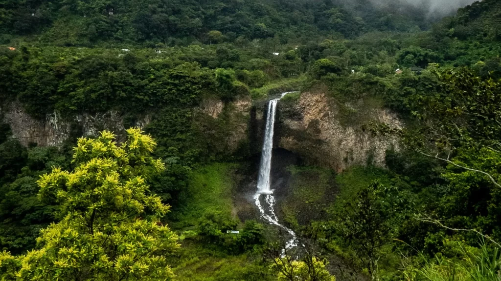
LE CASCATE DI MINDO E I SENTIERI DELLA FORESTA PLUVIALE
Ideale per:Passeggiate nella foresta pluviale, cascate e viaggiatori appassionati di uccelli, piante e paesaggi tropicali umidi.
DOVE SI TROVA E COME ARRIVARCI
Mindo si trova nella provincia di Pichincha, a circa 80 chilometri a nord-ovest di Quito. Il viaggio dura solitamente tra un'ora e mezza e due ore in auto privata, a seconda del traffico e delle soste lungo il percorso.
All'area delle cascate si accede percorrendo la Vía a las Cascadas, all'interno della foresta pluviale di Mindo-Nambillo. Alcuni percorsi partono nei pressi della tarabita, una funivia a cielo aperto che attraversa la valle e consente di raggiungere la rete principale di sentieri.
PERCORSI DISPONIBILI E LIVELLO DI DIFFICOLTÀ
IlSantuario delle Cascatecollega diverse cascate attraverso sentieri forestali segnalati. Per completare un percorso più lungo occorrono dalle 2 alle 4 ore, mentre gli itinerari più brevi possono concentrarsi su una o due cascate soltanto.
Il percorso presenta gradini, discese e attraversamenti di ruscelli. La maggior parte dei percorsi è considerata di difficoltà da facile a moderata, anche se la pioggia può rendere alcuni tratti fangosi o scivolosi.
CONDIZIONI METEOROLOGICHE E CONDIZIONI PRATICHE
A Mindo il clima è umido tutto l'anno, pertanto si consigliano indumenti impermeabili e scarpe con una buona aderenza. Si raccomanda inoltre ai visitatori di portare con sé acqua, repellente per insetti e indumenti che si asciughino rapidamente.
In alcune piscine naturali potrebbe essere possibile nuotare, ma le condizioni variano a seconda delle precipitazioni e del livello dell'acqua. Il giorno della visita, è opportuno chiedere conferma a una guida o a un operatore locale per verificare dove sia consentito entrare in acqua.
UN'ESPERIENZA FLESSIBILE NELLA FORESTA PLUVIALE
Il programma “Turismo responsabile” include la visita alla foresta pluviale di Mindo nell’ambito di viaggi più lunghi in Ecuador. A seconda dell’itinerario, la visita può combinare una passeggiata nella foresta con la scoperta di cascate, il birdwatching o altre attività locali.
Il percorso può essere adattato al ritmo e agli interessi del viaggiatore, da una breve passeggiata nel bosco a un circuito più lungo tra le cascate. L’uso della tarabita, la durata della camminata e il numero di cascate possono variare a seconda dell’esperienza scelta, delle condizioni meteorologiche e dello stato del sentiero.
IL PARCO NAZIONALE EL CAJAS, NEI PRESSI DI CUENCA
Ideale per:Laghi d'alta quota, paesaggi del páramo e viaggiatori alla ricerca di un'escursione giornaliera flessibile con partenza da Cuenca.
DOVE SI TROVA E COME ARRIVARCI
Il Parco Nazionale El Cajas si trova a ovest di Cuenca, nella provincia di Azuay. La zona di Toreadora dista circa 32 chilometri dalla città ed è solitamente raggiungibile in circa 35-45 minuti con un veicolo privato, a seconda del traffico e delle condizioni stradali.
I mezzi pubblici raggiungono alcune zone del parco, anche se i mezzi privati o i servizi di trasporto organizzati offrono maggiore flessibilità nella scelta del punto di partenza e dell'orario di ritorno.
PERCORSI DISPONIBILI E LIVELLO DI DIFFICOLTÀ
Diversi percorsi ufficiali partono nei pressi della zona di Toreadora e attraversano laghi, zone umide e praterie d'alta quota. La durata della camminata e il grado di difficoltà variano a seconda del percorso scelto.
Il terreno può presentare irregolarità, tratti bagnati e zone esposte. L'altitudine, il vento e gli sbalzi meteorologici possono inoltre rendere un percorso breve più impegnativo di quanto la sua distanza lasci intendere.
CONDIZIONI METEOROLOGICHE E CONDIZIONI PRATICHE
Le condizioni meteorologiche a El Cajas possono cambiare rapidamente: nel corso della stessa visita possono verificarsi temperature rigide, pioggia, nebbia e venti forti. Si consiglia di indossare indumenti a strati pesanti, abbigliamento impermeabile e calzature con una buona aderenza al terreno.
Prima della partenza è opportuno verificare i requisiti di accesso, i servizi disponibili e le condizioni dei sentieri consultando le informazioni ufficiali sul parco fornite da ETAPA.
UNA GITA DI UN GIORNO CON PROGRAMMA FLESSIBILE DA CUENCA
El Cajas può essere inserito come gita giornaliera flessibile con partenza da Cuenca. Il percorso e la durata della camminata possono essere adattati in base alle condizioni meteorologiche, allo stato del parco e al livello di forma fisica del viaggiatore.
Responsible Travel può includere il parco in un itinerario più ampio che attraversa Cuenca e le Ande meridionali, con i trasporti e l’assistenza di una guida locale organizzati in base all’esperienza scelta.
ALAUSÍ E IL TRENO DEL “NASO DEL DIAVOLO”
Ideale per:Storia ferroviaria, paesaggi montani e viaggiatori interessati a una tappa culturale tra Riobamba e Cuenca.
DOVE SI TROVA E COME ARRIVARCI
Alausí si trova nella provincia di Chimborazo ed è raggiungibile in auto da Riobamba, Cuenca e altre località delle Ande centrali. Il viaggio in treno ha inizio e fine alla stazione di Alausí.
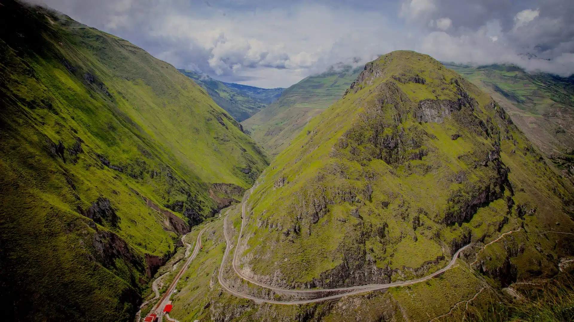
L'attuale percorso si snoda tra Alausí e Sibambe prima di tornare in città. Il servizio è normalmente attivo dal giovedì alla domenica e nei giorni festivi, con diverse partenze durante la giornata.
L'ESPERIENZA IN TRENO
Il percorso si snoda lungo il tratto ferroviario in forte pendenza noto come “Il Naso del Diavolo”, dove i binari scendono attraverso una serie di tornanti. L’esperienza completa, compreso il check-in e il ritorno ad Alausí, dura circa due ore.
Orari, tariffe e disponibilitàpotrebbero subire variazioni, pertanto è consigliabile confermare i biglietti prima della partenza. Si consiglia di prenotare in anticipo nei fine settimana e nei giorni festivi.
QUANDO IL TRENO NON È DISPONIBILE
I servizi ferroviari potrebbero subire sospensioni temporanee a causa di forti piogge, frane, lavori di manutenzione o ispezioni di sicurezza. In tali casi, i viaggiatori potranno comunque visitare Alausí, esplorare i punti panoramici della zona e scoprire la storia della ferrovia.
Un itinerario personalizzato può sostituire il viaggio in treno con una passeggiata o un'attività culturale nei dintorni, a seconda dell'accessibilità stradale e delle condizioni del momento.
UNA TAPPA FLESSIBILE IN UN ITINERARIO IN ECUADOR
Responsible Travel può includere il treno del “Naso del Diavolo” nell’ambito di un viaggio più lungo attraverso le Ande ecuadoriane. L’esperienza è soggetta all’operatività ferroviaria e alla disponibilità dei biglietti.
In caso di sospensione del servizio, l'itinerario può essere modificato per includere Alausí, i punti panoramici nelle vicinanze o un'altra attività lungo il percorso tra Riobamba e Cuenca.
CONFRONTA QUESTE ESCURSIONI IN GIORNATA E QUESTE ESPERIENZE
Ogni destinazione offre una combinazione diversa di tempo di percorrenza a piedi, altitudine, paesaggio e accessibilità. Il confronto riportato di seguito può aiutarti a individuare l’esperienza più adatta al tuo itinerario e al livello di attività che preferisci.
| Esperienza | Punto di accesso principale | Tempo di percorrenza tipico | Fattori di difficoltà | Ideale per |
|---|---|---|---|---|
| Laguna di Limpiopungo | Quito o il Parco Nazionale del Cotopaxi | Circa 1–1,5 ore | Terreno prevalentemente pianeggiante; altitudine e condizioni meteorologiche mutevoli del páramo | Una piacevole passeggiata in alta quota con vista sul Cotopaxi |
| Lago del cratere di Quilotoa | Quito, Latacunga o Zumbahua | Da una breve visita panoramica a 1,5–3 ore per la discesa nel cratere | Sentiero ripido, altitudine, terreno instabile e possibile nebbia | Viaggiatori alla ricerca di percorsi a piedi flessibili e paesaggi vulcanici |
| Cascate di Mindo | Mindo, a circa 1,5–2 ore da Quito | Circa 2–4 ore per un percorso più lungo lungo la cascata | Gradini, discese, umidità e tratti scivolosi dopo la pioggia | Passeggiate nella foresta pluviale, cascate e osservazione degli uccelli |
| Il Parco Nazionale di El Cajas | Cuenca | Varia a seconda del percorso ufficiale selezionato | Altitudine, terreno bagnato, vento, nebbia e sbalzi meteorologici improvvisi | Laghi d'alta quota ed escursioni nel páramo adatte a tutti |
| Alausí e il Naso del Diavolo | Alausí | Circa 2 ore per l'esperienza in treno | Disponibilità dei treni, condizioni meteorologiche e condizioni di accesso attuali | Storia ferroviaria, paesaggi culturali e una sosta tra Riobamba e Cuenca |
I tempi di percorrenza a piedi sono indicativi. Il percorso definitivo può variare in base alle condizioni meteorologiche, alle condizioni di accesso sul posto, al tempo a disposizione e all’andatura del viaggiatore.
COSA METTERE IN VALIGIA E COME FARE ESCURSIONI IN SICUREZZA
Le condizioni variano notevolmente tra il páramo, i paesaggi vulcanici e la foresta pluviale dell’Ecuador. Verificate le condizioni meteorologiche e le informazioni aggiornate sui sentieri prima della partenza, anche quando il percorso è previsto come una breve escursione giornaliera.
- Prepararsi all'altitudine:Limpiopungo, Quilotoa ed El Cajas si trovano ad altitudini elevate. Camminate a passo regolare, bevete acqua regolarmente e concedetevi il tempo necessario per acclimatarvi prima di affrontare un percorso impegnativo.
- Reagire ai sintomi:Mal di testa, nausea, stanchezza insolita o vertigini possono essere segni che l'altitudine ti sta dando fastidio. Fermati, riposa e avvisa la guida o il tuo compagno di viaggio, invece di proseguire la salita.
- Vestiti in modo adeguato alle condizioni meteorologiche mutevoli:Per le Ande, portate con voi indumenti pesanti e impermeabili. A Mindo, è più pratico indossare capi leggeri che si asciugano rapidamente, oltre a un repellente per insetti.
- Scegli calzature adeguate:Si consigliano scarpe con una buona aderenza per i terreni vulcanici sciolti, il páramo bagnato e i sentieri forestali fangosi.
- Portate con voi acqua e cibo:I servizi potrebbero essere limitati in prossimità del sentiero o non disponibili in alcuni tratti del percorso. Portate con voi acqua a sufficienza e uno spuntino leggero per la durata prevista dell'escursione.
- Utilizza una protezione solare:L'alta quota può aumentare l'esposizione ai raggi ultravioletti, anche quando il cielo è nuvoloso. Portate con voi crema solare, occhiali da sole e un cappello.
- Tieni a disposizione un po’ di contanti:I piccoli punti di ingresso, i servizi locali e le attività commerciali rurali potrebbero non accettare pagamenti con carta.
- Modifica il percorso se necessario:Pioggia, nebbia, danni al sentiero o limitazioni temporanee potrebbero rendere necessario accorciare la passeggiata o optare per un’attività diversa.
ORGANIZZARE UN'ESCURSIONE GIORNALIERA SU MISURA IN ECUADOR
Un’escursione giornaliera può essere inclusa nell’ambito di un viaggio privato o di un itinerario più lungo attraverso l’Ecuador. Responsible Travel aiuta a scegliere un’esperienza che si adatti al tempo a disposizione del viaggiatore, al suo livello di forma fisica e ai suoi interessi.
Il trasporto, l’assistenza in loco e gli orari delle attività possono essere organizzati in base al percorso scelto. Il programma potrà inoltre tenere conto dell’altitudine, delle previsioni meteorologiche e delle condizioni di accesso attuali prima della partenza.
Alcuni viaggiatori potrebbero preferire una breve passeggiata seguita da una visita culturale, mentre altri potrebbero optare per un percorso più lungo o abbinare l’escursione a un pernottamento nelle vicinanze. L’esperienza può essere personalizzata senza costringere tutti i viaggiatori a seguire lo stesso itinerario.
Responsible Travel collabora con guide locali, comunità e operatori turistici nelle destinazioni incluse nell’itinerario. Qualora le condizioni meteorologiche o restrizioni temporanee dovessero influire su un’attività, il percorso potrà essere modificato o sostituito con un’altra esperienza adeguata.
SCEGLI L'ESCURSIONE GIORNALIERA PIÙ ADATTA AL TUO VIAGGIO IN ECUADOR
L'itinerario migliore dipenderà dalla vostra destinazione, dal tempo a vostra disposizione e dal livello di attività che preferite. Limpiopungo offre un approccio più agevole alle Ande, mentre Quilotoa vi permette di scegliere tra punti panoramici, passeggiate lungo il bordo del cratere e una discesa più ripida all'interno del cratere.
Mindo è la meta ideale per i viaggiatori affascinati dalle cascate e dalla foresta pluviale. El Cajas offre percorsi in alta quota nelle vicinanze di Cuenca, mentre Alausí permette di rivivere la storia delle ferrovie in un viaggio attraverso le Ande centrali.
DOMANDE FREQUENTI: ESCURSIONI GIORNALIERE IN ECUADOR
QUAL È L'ESCURSIONE GIORNALIERA PIÙ ADATTA AI PRINCIPIANTI IN ECUADOR?
Limpiopungo è spesso l'opzione più agevole, poiché il terreno intorno alla laguna è relativamente pianeggiante. L'altitudine può comunque mettere a dura prova alcuni viaggiatori, quindi è importante procedere con calma e concedersi il tempo necessario per acclimatarsi.
MI SERVE UNA GUIDA PER QUESTE ESCURSIONI IN GIORNATA?
Alcuni itinerari possono essere percorsi in autonomia, ma una guida può fornire assistenza per quanto riguarda i trasporti, le condizioni di accesso del momento e la scelta del percorso. L’assistenza di una guida è particolarmente utile quando le condizioni meteorologiche, l’altitudine o il tempo a disposizione potrebbero influire sul programma.
QUALI SONO LE DESTINAZIONI PIÙ INFLUENZATE DALL'ALTITUDINE?
Limpiopungo, Quilotoa ed El Cajas si trovano tutte ad altitudini elevate. I viaggiatori che arrivano direttamente da zone a quota più bassa potrebbero avvertire affaticamento, mal di testa o difficoltà respiratorie prima del previsto.
È POSSIBILE ADATTARE IL PERCORSO A PIEDI AL MIO LIVELLO DI FORMA FISICA?
Sì. A Quilotoa è possibile limitarsi ai punti panoramici oppure spingersi fino al cratere, mentre Mindo ed El Cajas offrono percorsi più o meno lunghi. La scelta finale dovrebbe tenere conto del ritmo del viaggiatore, del tempo a disposizione e delle condizioni meteorologiche del giorno.
COSA SUCCEDE SE LE CONDIZIONI METEOROLOGICHE COMPROMETTONO L'ESCURSIONE IN PROGRAMMA?
Pioggia, nebbia, vento forte o chiusure temporanee potrebbero richiedere un percorso più breve o un’attività alternativa. In un itinerario personalizzato, è possibile adattare la giornata senza compromettere lo svolgimento generale del viaggio.
POSSO INSERIRE UNA DI QUESTE ESCURSIONI IN UN ITINERARIO PIÙ LUNGO IN ECUADOR?
Sì. Queste esperienze possono essere abbinate a Quito, Cuenca, alle Ande centrali, alla foresta pluviale o ad altre destinazioni, a seconda dell'itinerario che state già seguendo.
ORGANIZZA UN'ESCURSIONE DI UN GIORNO DURANTE IL TUO VIAGGIO IN ECUADOR
Facci sapere dove andrai, quanto tempo hai a disposizione e che tipo di escursioni ti piacciono. Il nostro team potrà suggerirti un’esperienza che si inserisca perfettamente nel tuo itinerario in Ecuador.